I looked at Sanborn maps to locate the members of the Edelweiss Club. First I had to find out where they lived. In the items in The Emancipator the address of the house where the meeting was to be hosted was often given, but that didn’t happen every time and it didn’t tell me where the other members lived, nor where they were in relationship to each other. I did what I do when I am studying people, I made each of them a tree on ancestry.com. All 37 of them, or as many as I could find.
I searched for them in the Montgomery City Directory for 1919 or in the U.S. census for 1920. Those gave me their addresses and their occupation. If I found the census and they were living with their families (most were) I also found their ages, their parents ages and occupations and information about their siblings. With that information I could start a tree later to learn more. At the beginning, I just wanted to find basic information for my blog post and then I wanted to find where they lived. When I decided to write something about them for National Novel Writing Month, I created more complete trees to find out when they moved to Montgomery, if they married, if they moved out of Montgomery to points North, East and West.
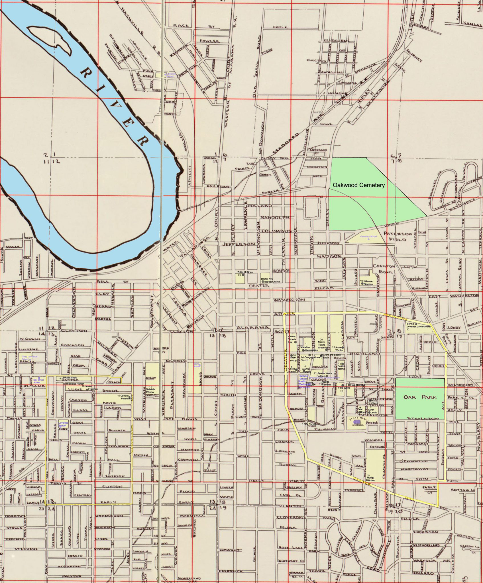
Where did the women live in Montgomery? Were they spread out or did they live near each other? I have only been to Montgomery twice, once in 1975 and once in 2009. I knew where the neighborhood my grandmother had lived in was, and it was mostly torn down and absorbed into downtown Montgomery. The building that housed her uncle Victor Tulane’s grocery store, was still standing, but that was about it. What churches did the members attend? Were they active in church work? Did they sing in a group? For those that worked in a family business, as my grandmother Fannie Turner did, where was the business located? Was there (hopefully) an old and faded photograph of it in the paper? Was there, perhaps a photo of the young woman in the newspaper? And a question difficult to find an answer to, were the unidentified women in my grandmother’s photo album Edelweiss members?
While looking for information, I came across a document about gentrifying, they called it “rehabbing”. It the area where Victor Tulane’s store was and they gave me a name for the neighborhood where the store, my family and most of the Edelweiss members lived – The Centennial Community, a historic black Montgomery community. Some of the churches and schools and a few of my family had lived in the black community known as West Montgomery. That was where Washington Park, where the last dance was held, was located. It was on the other side of town from the Centennial Community. I found where the “Peacock Tract”, an early black, community was located and why there was a school way up in the northeast part of the city – another smaller, black community. Some of these questions I have answered – I found most of the members lived within walking distance of each other. At least so it looks on the map. I found all of my family members living within walking distance of each other. I located cemeteries, churches, drugstores, and private schools. There were a number of schools that were not a part of the public school system that had been started by northern missionaries after the Civil War. Aside from finding where the young women lived using the Sanborn maps, I was also able to find the relative size of the houses and schools. For the schools and churches, the type of heat and the source of light was given. If the streets were paved or not was more information. Most of the streets were not paved. Some of the schools had no heat. Lights were lanterns, or big windows in some cases. Reading the news articles, there were many drives by black citizens to raise money to repair schools, buy equipment and even built new additions.
Discover more from Finding Eliza
Subscribe to get the latest posts sent to your email.
This is fantastic data about family members and communities! I do invent trees on Ancestry to see who historically has any descendants that might have been neighbors…will certainly start considering maps especially of cities. Lots of farms would be a bit harder to locate though.
Yes farms are harder than cities. I have found so much information using maps for my city ancestors. Not so much the rural ones. Good luck.